.png)
 1 year ago
🎙️ Daily Podcast (FR) : NViNiO•Podcast™
ADs | ✨ Enhance your Social Media content with NViNiO•AI™ for FREE
We’re taking a look back at the major launches, moments and milestones that made Google Earth what it is today.

Yael Maguire
VP & GM, Google Maps Platform & Google Earth
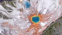
For 20 years, Google Earth has helped us explore and understand the world. With billions of images across aerial photography, satellite imagery, Street View and 3D visuals, Google Earth offers a stunning view of our world. Over the past two decades, people have used it to build more resilient cities, stronger communities and a healthier planet. In just the past year, people searched for places in Google Earth more than 2 billion times.
Today, we’re celebrating this milestone birthday by bringing historical Street View imagery to Google Earth. Now you can explore the wonders of the planet from even more viewpoints, whether it’s a bird’s eye view or at street level. We’re also looking back at Google Earth’s biggest moments:
2005: Google Earth went viral at launch and was downloaded 100 million times in just its first week. Two months later, Hurricane Katrina hit, and we quickly worked with the National Oceanic and Atmospheric Administration (NOAA) to make updated imagery available to first responders on the ground — a preview of our future impact.
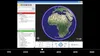
Google Earth’s interface in 2005.
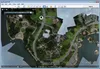
Imagery from 2012 taken from kites and balloons.
2014: To highlight the beauty of our planet, we launched Earth View, an easy-to-use Chrome extension that creates digital wallpaper and screensavers from a collection of the most beautiful landscapes seen from space.

In Google Earth, professionals can evaluate feasibility for a building design or a solar site.

2024: We added historical imagery to Google Earth on web and mobile, making it easy for a much larger audience to explore our rich library of satellite and aerial imagery. We also introduced Gemini in Google Earth to help urban planners access deeper, city-level insights, like information about locations of EV chargers.
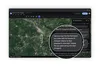
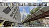
2025: Last year, #somewhereonGoogleMaps started trending on social media, with people around the globe using historical Street View to virtually time travel and see how a place evolved over time. Now, you can access historical Street View imagery right from Google Earth — and if you use Google Earth in a professional capacity, you can easily access new datasets, like tree canopy coverage for cities, land temperatures and more. Learn more in our blog post.
Here’s to you and our entire Google Earth community for all the incredible ways you’ve used Google Earth since 2005. Cheers to the next 20! 🥳







 English (United States) ·
  French (France) ·